


Dubai New 80km Road Project: Route Map, Interchanges & Commute Guide (2026)
At 7:15 AM on a Tuesday, the brake lights on Sheikh Mohammed bin Zayed Road stretch into a crimson river as far as the eye can see, with trucks idling next to school buses under the morning sun. Sitting in that standstill near City Centre Mirdif, watching the navigation screen add twenty minutes to what should be a straightforward commute, you feel the urgent necessity of Dubai's transit expansion in your steering wheel hands.
The Roads and Transport Authority (RTA) has just unveiled the comprehensive route maps and blueprint alignments for the city's new 80-kilometre Fourth Transit Corridor. Having studied the engineering schematics and driven the feeder roads currently preparing for heavy grading, this multi-lane bypass is about to fundamentally reshape how everyone from Sharjah daily commuters to southern villa residents navigates the emirate.
What Is the 80km Fourth Corridor Project? The Core Route Alignment
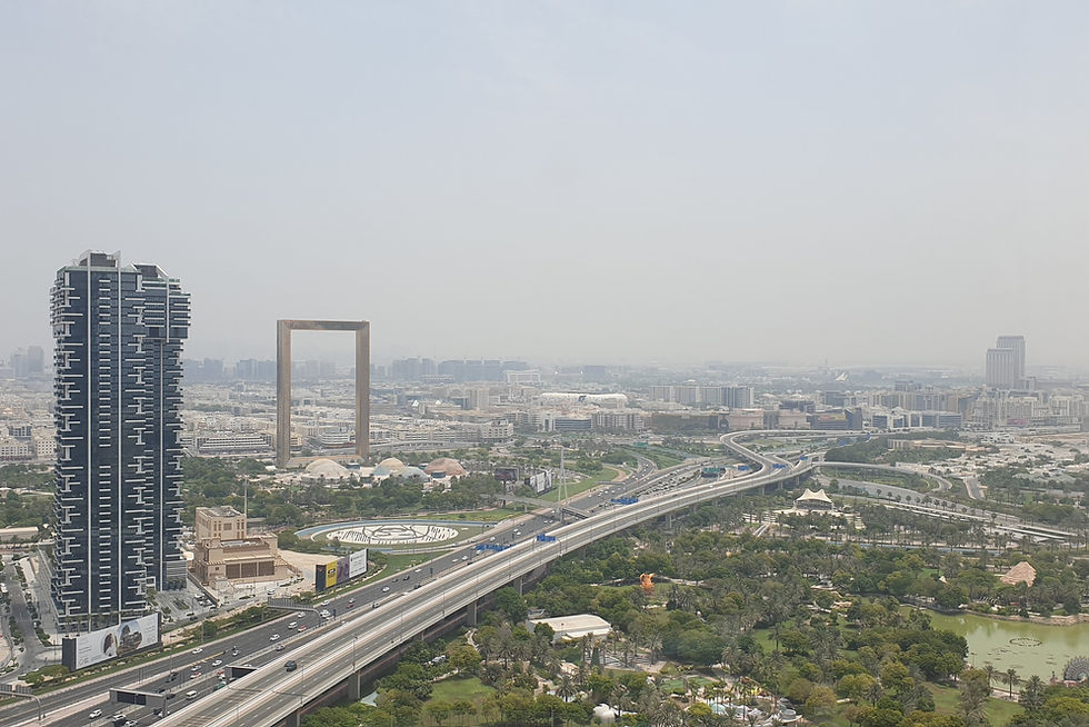
The Roads and Transport Authority (RTA) has greenlit an 80-kilometre multi-lane transit corridor designed as a strategic bypass between Dubai’s eastern residential frontier and southern industrial hubs. Spanning from the Sharjah-Dubai border area down to the outskirts of Expo City Dubai and the Abu Dhabi gateway, the alignment runs parallel to Emirates Road (E611) and Sheikh Mohammed bin Zayed Road (E311), creating a true fourth longitudinal expressway for the emirate.
With up to six lanes in each direction in primary segments, the project expands network capacity by over 14,000 vehicles per hour per direction. The RTA’s strategic master plan aims to absorb cross-emirate commuter traffic—heavy vehicles, delivery logistics, and daily office commuters traveling between the Northern Emirates and Jebel Ali or Abu Dhabi—without forcing cars into inner ring roads like Al Khail Road (E44) or Sheikh Zayed Road (E11).
The Four Arterial Expressways in Sequence
Dubai’s transit spine now stacks into four distinct longitudinal tiers: Sheikh Zayed Road (E11) closest to the coast, Al Khail Road (E44) serving central business districts, Sheikh Mohammed bin Zayed Road (E311) linking established suburbs, and this newly expanded 80km Fourth Corridor aligning along and beyond Emirates Road (E611) to intercept peripheral traffic.
If you commute between Sharjah and Jebel Ali daily, staying out of the central E11 and E44 gridlock will soon save you over an hour of bumper-to-bumper clutch wear every single day.
Key Interchanges and Flyovers: Where the New Road Connects
The 80km corridor does not rely on at-grade roundabouts or traffic signals; it is engineered as a grade-separated expressway linked by multi-tier directional flyovers. These major interchange upgrades dismantle historical bottlenecks where suburban arterials converge with inter-emirate freeways.
Dubai-Al Ain Road (E66) Interchange Upgrade
A multi-level directional interchange will allow free-flowing traffic transitions between E66 and the new corridor. Drivers heading from Dubai Silicon Oasis and Academic City toward Dubai South will no longer need to merge through the congested Academic City Road signals, shaving at least 15 minutes off southern connections.
Sheikh Zayed bin Hamdan Al Nahyan Street (D54) Link
The project seamlessly integrates with D54, expanding flyover capacity at the junctions serving Dubai Sports City, Damac Hills, and Tilal Al Ghaf. Two new underpasses and four multi-lane bridge links will channel westbound traffic directly toward Al Yalayis Street (D57) and the Jebel Ali Industrial zones.
Al Yalayis and Expo Road (E77) Junctions
Connecting into Expo Road (E77) near Al Maktoum International Airport (DWC), this junction establishes high-speed connectivity for freight and logistics hubs servicing the multi-billion-dirham DWC expansion program, isolating heavy articulated trucks from passenger lanes.
Commute Times Compared: Old Routes vs. The New 80km Corridor
To appreciate the scale of relief, drivers need to look at real transit numbers during the dreaded 06:30–09:00 morning rush and 17:00–19:30 evening return. Peak-hour bottlenecks at Maliha Road, National Paints interchange, and the E311 Al Barsha corridor add tens of wasted hours to monthly schedules.
Commuter Route | Current Peak Travel Time | Projected Travel Time via 80km Corridor | Time Saved | Primary Alternative Road |
|---|---|---|---|---|
Sharjah (Maliha Rd) to Jebel Ali Free Zone | 85–105 minutes | 45–50 minutes | 40–55 minutes | E311 (Sheikh Mohammed bin Zayed Rd) |
Academic City / Silicon Oasis to Expo City | 45–60 minutes | 22–25 minutes | 20–35 minutes | E44 / D54 through Motor City |
Dubailand (The Villa / Arabian Ranches) to DWC Airport | 40–50 minutes | 18–20 minutes | 20–30 minutes | Al Qudra Road (D63) |
Ajman to Abu Dhabi Border (Ghantoot) | 110–135 minutes | 65–75 minutes | 45–60 minutes | E11 / E311 coastal corridors |
Communities Benefiting Most: Who Sees Immediate Traffic Relief
While long-distance freight and inter-emirate commuters see the biggest mileage advantages, over 25 inland master communities will experience immediate drops in morning arterial congestion. Residents in southern and eastern Dubai developments currently struggle with single-point bottleneck exits onto E311 and E611.
Dubailand and The Villa: Direct flyover connectivity onto the new bypass eliminates the bottleneck at the Dubai-Al Ain Road junction.
DAMAC Hills, Remraam, and Mudon: New grade-separated links onto D54 and the 80km corridor bypass the congested Hessa Street (D61) roundabout and signal corridors.
Town Square and Mira: High-speed lateral ramps directly tie into Al Qudra Road, eliminating morning tailbacks toward Motor City.
Dubai South and Expo City: Direct multi-lane access routes support the thousands of aviation and logistics personnel moving into Al Maktoum International Airport communities.
Living out in Arabian Ranches or Town Square used to mean factoring in 20 minutes just to escape your neighborhood feeder road—this corridor adds three new unhindered release valves.
Toll Gates and Salik Considerations: Will Drivers Pay to Commute?
Whenever the RTA announces an expressway upgrade in Dubai, drivers immediately question whether new Salik toll gates will be installed. As of 2026, the RTA and Salik PJSC maintain dynamic tolling strategies across core inner highways like Al Khail Road and Business Bay Crossing, designed to distribute traffic onto outer peripheral corridors.
Tolling Philosophy for Outer Corridors
The 80km Fourth Corridor is purposely engineered as a bypass to pull traffic away from Dubai's dense urban core. Introducing immediate toll gates on peripheral routes like E611 and its parallel collector roads would run counter to the RTA’s congestion-management goal of disincentivizing drivers from using central toll-free side streets.
Variable Toll Tariffs on Connecting Feeder Roads
While the primary bypass remains toll-free, motorists must account for dynamic Salik gates when peeling off into central corridors like Al Khail Road or the Dubai Financial Centre exits, where peak-hour toll charges apply under Salik’s intelligent traffic management framework.
Construction Phasing, Detour Tips, and Delivery Timeline (2026–2028)
The 80km project is being rolled out across three sequential construction packages to prevent total gridlock across existing southern bypasses. Motorists navigating the construction zones should understand the active works schedule and take practical steps to navigate daily temporary diversions.
The Three Phased Milestones
Phase 1 focuses on the critical bridge widening and interchange reconstruction linking E66 to D54, scheduled for operational testing by late 2026. Phase 2 extends southward to Al Yalayis Street (D57) through 2027, while Phase 3 completes the final connection to Expo Road (E77) and the Abu Dhabi territorial border by 2028.
Practical Navigation Tips for Drivers
Active bridge construction means lane realignments around Al Qudra and Academic City. Maintain strict 80 km/h temporary speed limit compliance through active construction segments, as Dubai Police radar cameras are calibrated to capture temporary construction-zone limits with fines starting at AED 600.
Keep your Waze or Google Maps running with live traffic re-routing even on roads you drive every day—RTA overnight diversions around D54 change weekly during active flyover girder placements.
FAQ
What is the official speed limit on Dubai's new 80km road project?
Primary expressway segments on the new corridor are designed for a 120 km/h posted speed limit, with radar buffer enforcement triggering at 141 km/h under Dubai's standard 20 km/h grace margin. Feeder ramps and directional interchange flyovers carry dedicated advisory limits between 60 km/h and 80 km/h.
Are heavy trucks and commercial vehicles permitted on the new corridor?
Yes, designated outer lanes are engineered specifically to accommodate heavy commercial transport 24 hours a day, providing heavy trucks with a non-stop bypass that avoids the daytime lane-ban restrictions imposed on inner roads like Al Khail and Sheikh Zayed Road.
Will Dubai Metro or public bus routes be integrated along the 80km road corridor?
While the corridor is primarily an expressway, the RTA's comprehensive master plan integrates dedicated rapid bus transit (BRT) priority lanes and multi-modal park-and-ride stations connecting to the upcoming Dubai Metro Blue Line and Expo City Red Line extensions.
How does the Fourth Corridor connect with neighboring emirates like Sharjah and Abu Dhabi?
At its northern end, the corridor feeds seamlessly into Sharjah's industrial and residential road network near Emirates Road, while the southern extremity ties directly into the truck-transit network leading to the E10 and E311 corridors toward Abu Dhabi, enabling cross-country travel without entering central Dubai.
Useful Links
RTA Dubai Official Portal · Emirates News Agency (WAM) · Dubai Police Traffic Services · UAE Official Government Portal · Salik Official Portal · Dubai Municipality
Pair It With
Dubai Metro Tips Hacks Rta Commuter Guide · How To Check And Pay Dubai Police Fines Online · Living In Al Jaddaf Dubai Rent Review

— Angel Tyagi, Creator of Angel In Dubai
Prices, timings and availability may change — always check directly with the venue before visiting. Not sponsored.
Story lead: gulfnews.com. Reporting can be updated or withdrawn after publication — always check the original before relying on anything here.
Rates and figures are indicative and were correct as of 17 September 2026; they change often, so verify with the provider before acting. This is general information, not financial advice.
Angel in Dubai is not a real-estate broker and holds no DLD or RERA advertising permit. Any prices here are reported market data as of the date noted — not an offer, and not an invitation to buy. Verify directly with the developer or on the Dubai Land Department portal.
Rules, fees and deadlines change often. This is a general summary, not legal advice — confirm with the relevant UAE authority before acting.
Photo by Dubai Half Day City Tour | Unveil the Gems of Dubai via web, Photo by Sudheeshthulaseedharan via wikimedia


Comments