Dubai Metro Gold Line: Where All 18 Stations Will Be Located
- 3 days ago
- 6 min read
Picture a Tuesday in 2032: you finish a late meeting near the Dubai Water Canal in Business Bay, walk down into a cool, deep station, and step onto a brand-new train that glides — entirely underground — out to a quiet villa community on the far side of the city, no Sheikh Zayed Road traffic in sight. That is the future the Dubai Metro Gold Line is built for, and this week the route finally came into focus on the map.
As Khaleej Times reported, the Gold Line will run 42 kilometres with 18 stations stitched across 15 of Dubai's busiest neighbourhoods. It was approved by Sheikh Mohammed bin Rashid Al Maktoum and unveiled on 22 April 2026, and The National puts the investment at AED 34 billion (around US$9 billion). Here is my resident's-eye breakdown of where it goes, which areas finally get a metro, and what it actually means for getting around — all as of June 2026.
What the Gold Line is — the headline numbers
Think of the Gold Line as Dubai's first fully underground metro line. Where the Red and Green Lines mostly glide overhead on viaducts, the Gold Line dives below the city — reportedly running up to 40 metres deep in places so it can thread under dense, already-built neighbourhoods without carving up the streets above. It is the kind of engineering that only makes sense once a city has run out of easy surface corridors, which is exactly where central Dubai is now.
Length & stations — 42 km with 18 stations spanning 15 strategic areas of Dubai (as of June 2026).
Underground — a fully integrated underground line — a first for the Dubai Metro network.
Investment — AED 34 billion (about US$9 billion), approved 22 April 2026.
Opening — targeted for 9 September 2032 — a date Dubai loves for metro milestones (09/09).
Capacity — projected to carry around 465,000 passengers a day by 2040 and benefit some 1.5 million people.
Network growth — expands the overall Metro network by roughly 35% and serves 55-plus development projects.

The route: from old Dubai to the new suburbs
The line is essentially a diagonal across the city. It begins at Al Ghubaiba, deep in historic Bur Dubai by the Creek, and runs south-west to terminate out at Jumeirah Golf Estates. In between, it carves through a corridor that has long been a black hole on the metro map: places where, today, you really do need a car.
According to the route map published by Khaleej Times, the 15 areas along the alignment include Al Ghubaiba, Mina Rashid, BurJuman, Bur Dubai and Al Satwa in the older heart of the city; City Walk, Business Bay, Meydan, Mohammed Bin Rashid City and Nad Al Sheba through the fast-growing middle; and Al Barsha South, Jumeirah Village Triangle, Jumeirah Village Circle, Dubai Production City and Jumeirah Golf Estates out towards the newer western communities. You can trace the start and end points yourself on Al Ghubaiba on Google Maps and Jumeirah Golf Estates to get a feel for just how much ground it covers.
A word of honesty, because I would want it myself: as of June 2026 the authorities have confirmed the corridor and the 15 areas, but a final, official station-by-station name list had not yet been published. So treat any neat "all 18 station names" graphic you see floating around as a best guess until the RTA confirms it — the areas below are the part that is actually on the record.
Which neighbourhoods finally get a metro
This is the part that genuinely changes daily life. Several of these communities have boomed over the last decade with almost no rail access at all. Jumeirah Village Circle and Jumeirah Village Triangle are home to tens of thousands of residents who currently rely entirely on cars, taxis and ride-hailing; Al Satwa and parts of Bur Dubai are dense, walkable and historic but oddly under-served; and Meydan and Mohammed Bin Rashid City are filling up with new towers and villas faster than the roads around them can cope.
If you have read my guide on renting in Dubai for the first time, you will know that proximity to a metro station can swing rents by thousands of dirhams a year. A confirmed future line tends to do the same to an area's appeal long before the first train runs — which is exactly why communities like Meydan and MBR City are worth watching closely now rather than in 2032.

Where it connects: interchanges and Etihad Rail
A new line only earns its keep if it plugs into the rest of the system, and this is where the Gold Line gets clever. The confirmed interchanges, per Khaleej Times and the official Dubai Government announcement, let you switch lines at several key points:
Al Ghubaiba — interchange with the existing Green Line, right at the line's Bur Dubai starting point.
BurJuman — a major hub connecting to both the Red and Green Lines — already one of the network's busiest swaps.
Business Bay — interchange with the Red Line, linking the Gold Line into the Downtown and Sheikh Zayed Road spine.
Jumeirah Golf Estates — the western terminus, connecting to the Red Line and to Etihad Rail.
Meydan — a planned connection to the UAE-wide Etihad Rail network for inter-emirate journeys.
That Etihad Rail tie-in is the quiet game-changer. With Etihad Rail building out passenger services across the Emirates, a Gold Line link at Meydan and Jumeirah Golf Estates hints at a future where you could roll from a Dubai suburb to Abu Dhabi or the Northern Emirates on rail alone. If you have ever weighed up living in Ras Al Khaimah and commuting into Dubai, this is the kind of joined-up network that could eventually make that maths work.

What it means for residents and visitors — and when
Let me set expectations honestly: 9 September 2032 is a long way off, and big infrastructure dates can move. So the Gold Line will not change your commute tomorrow. What it changes today is how you think about where you live, buy or base yourself. A car-dependent area with a confirmed future station is a very different proposition from one with no rail on the horizon at all.
For visitors, the takeaway is simpler and further out: by the time the line opens, getting from old Dubai's Creek and souks to the Jumeirah Village communities — or out towards the golf estates — will be a single underground ride rather than a long, meter-ticking taxi. For residents, it is a reminder that Dubai keeps betting on public transport, and that the city's car-first reputation has a real expiry date.
In the meantime, the smartest move is to actually use the metro you already have. My guide to the Nol 30-day travel pass breaks down how to ride the Red and Green Lines for less right now, and a fuller picture of the project sits on the Gold Line reference page if you want to follow every update as the RTA confirms more. I will keep this post refreshed as official station names and timelines are released.
All figures — 42 km, 18 stations, 15 areas, AED 34 billion, the 2032 opening and the 2040 ridership projection — are as of June 2026 and are drawn from public reporting by Khaleej Times and The National and the official Dubai Government announcement. A final official station-by-station list had not been published at the time of writing; details can change, so confirm with the RTA before planning around them. This is general information, not investment or travel advice.

— Angel Tyagi, Creator of Angel In Dubai
Not sponsored. Routes, timelines, station details and opening dates for major infrastructure can change — always check the RTA and official Dubai Government channels for the latest before you plan around them.
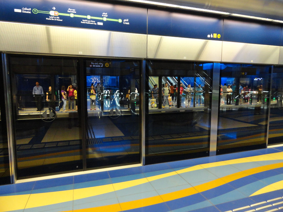
Photos: the cover Dubai Metro platform by Ravi Dwivedi (CC BY-SA 4.0) and the Gold Class train interior by Shahroozporia, both via Wikimedia Commons; the platform with commuters by Fabio Achilli and BurJuman station by Tim Wu, also via Wikimedia Commons; and the Business Bay / Dubai Water Canal aerial by Mustafa Turhan via Unsplash. All images depict the real Dubai Metro network and Dubai, and were reviewed this session for subject and quality.


Comments